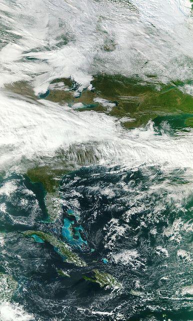
 http://www.flickr.com/photos/gsfc/6385184555/
A high-resolution version of the first VIIRS image created the NASA NPP Team at the Space Science and Engineering Center, UW-Madison.
Credit: NASA/NPP Team
NASA Goddard Space Flight Center enables NASAs mission through four scientific endeavors: Earth Science, Heliophysics, Solar System Exploration, and Astrophysics. Goddard plays a leading role in NASAs accomplishments by contributing compelling scientific knowledge to advance the Agencys mission.
VIIRS, a scanning radiometer, collects visible and infrared imagery and radiometric measurements of the land, atmosphere, cryosphere, and oceans. It extends and improves upon a series of measurements initiated by the Advanced Very High Resolution Radiometer (AVHRR) and the Moderate Resolution Imaging Spectroradiometer (MODIS). VIIRS data is used to measure cloud and aerosol properties, ocean color, sea and land surface temperature, ice motion and temperature, fires, and Earth's albedo. Climatologists use VIIRS data to improve our understanding of global climate change.
http://npp.gsfc.nasa.gov/viirs.html