Welcome to DU! The truly grassroots left-of-center political community where regular people, not algorithms, drive the discussions and set the standards. Join the community: Create a free account Support DU (and get rid of ads!): Become a Star Member Latest Breaking News General Discussion The DU Lounge All Forums Issue Forums Culture Forums Alliance Forums Region Forums Support Forums Help & Search
MichaelSoE

(1,576 posts)
Fri Sep 11, 2020, 06:42 AM Sep 2020

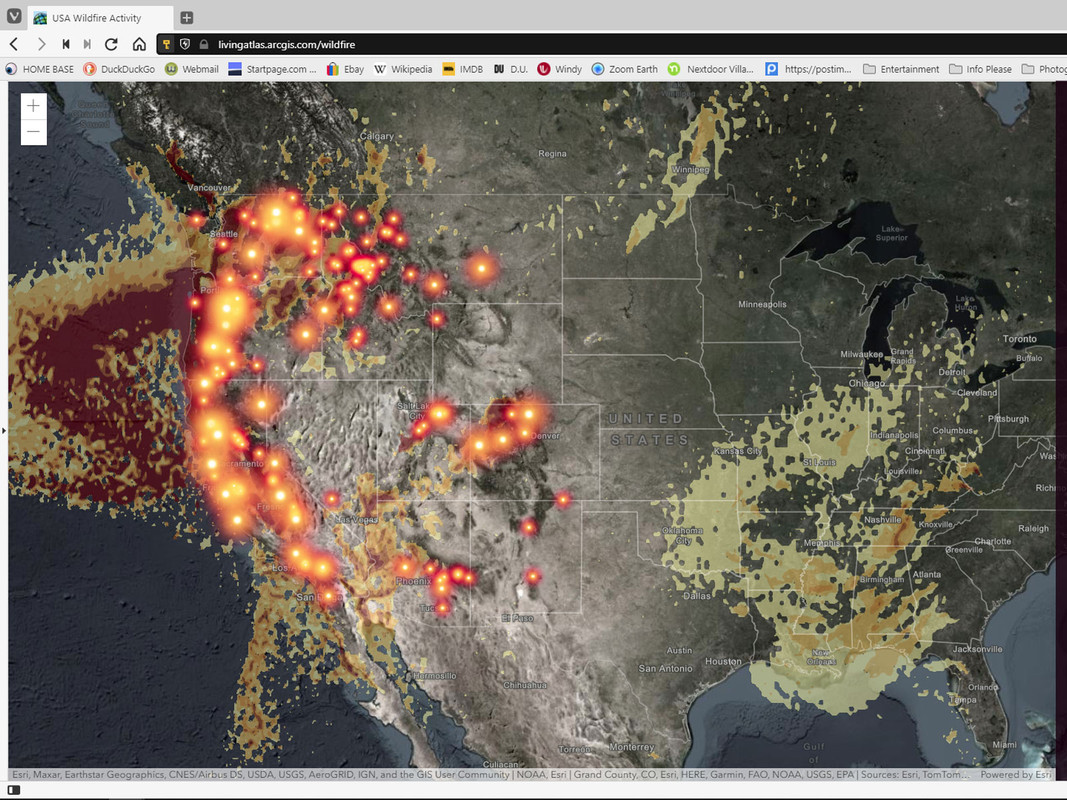
Screen cap of active fires in the US ... tossed in map of the Atlantic with hurricanes too


Here is a link to the website ... it's interactive ... I turned the smoke layer for the screen cap

https://livingatlas.arcgis.com/wildfire/#@=-105.715,39.921,5


From the web site Windy ... also totally interactive

https://www.windy.com

So much to do. So little time.

But get rid of ALL the deniers first


3 replies = new reply since forum marked as read
Highlight: NoneDon't highlight anything 5 newestHighlight 5 most recent replies
Screen cap of active fires in the US ... tossed in map of the Atlantic with hurricanes too (Original Post) MichaelSoE Sep 2020 OP
Get thee to the greatest page malaise Sep 2020 #1
And 2020 continues to be Sherman A1 Sep 2020 #2
Windy.com Enterstageleft Sep 2020 #3

Enterstageleft

(3,396 posts)
3. Windy.com
Fri Sep 11, 2020, 02:35 PM
Sep 2020

I've been using windy for about 3 years.

One of the most accurate & interesting weather sites available.

Latest Discussions»General Discussion»Screen cap of active fire...