General Discussion
Related: Editorials & Other Articles, Issue Forums, Alliance Forums, Region ForumsCECOT's coordinates in Google Earth are 13.534500, -88.805510
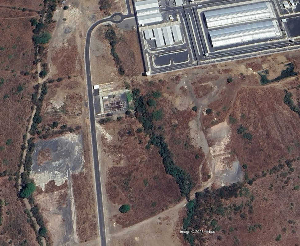
I'm not going to post what I theorize is going on at that place, but I found the terrain to the left and south of the facility strange looking.
You're going to see some rough roads that appear to have been driven on. The roads lead to nothing except disturbed terrain that presents as a white color, while all of the terrain around these areas remain green/brown and natural looking.
All of this most likely means nothing more than I've been on the internet too long today. Below is a screen shot, but if you go to Google earth and zoom in, you can see how these white roads, and white areas do not match up with the surrounding natural terrain.
And that's all I have to say about this at this point.
 = new reply since forum marked as read
Highlight:
NoneDon't highlight anything
5 newestHighlight 5 most recent replies
= new reply since forum marked as read
Highlight:
NoneDon't highlight anything
5 newestHighlight 5 most recent replies

LuckyCharms
(23,090 posts)
ForgedCrank
(3,120 posts)see are obvious signs of erosion
LuckyCharms
(23,090 posts)
Jit423
(1,568 posts)
Lars39
(26,553 posts)The other being mass graves. 
LuckyCharms
(23,090 posts)and was used by the Nazi's under the theory that quick lime speeds up decomposition.
How efficient of them. 
True Dough
(27,315 posts)a family vacation, or what?


Kick in to the DU tip jar?
This week we're running a special pop-up mini fund drive. From Monday through Friday we're going ad-free for all registered members, and we're asking you to kick in to the DU tip jar to support the site and keep us financially healthy.
As a bonus, making a contribution will allow you to leave kudos for another DU member, and at the end of the week we'll recognize the DUers who you think make this community great.