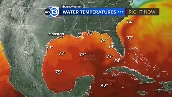
JUST IN: Subtropical Storm #Alberto has formed in the northwestern Caribbean Sea....
Source: ABC News
Link to tweet
JUST IN: Subtropical Storm #Alberto has formed in the northwestern Caribbean Sea, National Hurricane Center says. 2018 hurricane season officially kicks off on June 1. https://abcn.ws/2IKxG47
Read more:
Link to tweet
Link to tweet
https://www.nhc.noaa.gov/text/refresh/MIATCPAT1+shtml/251443.shtml
000
WTNT31 KNHC 251443
TCPAT1
BULLETIN
Subtropical Storm Alberto Advisory Number 1
NWS National Hurricane Center Miami FL AL012018
1000 AM CDT Fri May 25 2018
...PRE-SEASON SUBTROPICAL STORM ALBERTO FORMS OVER THE NORTHWESTERN
CARIBBEAN SEA...
...HEAVY RAINFALL EXPECTED TO AFFECT THE YUCATAN PENINSULA...WESTERN
CUBA...FLORIDA...AND THE NORTHEASTERN GULF COAST THROUGH THE
WEEKEND...
SUMMARY OF 1000 AM CDT...1500 UTC...INFORMATION
-----------------------------------------------
LOCATION...19.7N 86.8W
ABOUT 55 MI...90 KM S OF COZUMEL MEXICO
ABOUT 195 MI...315 KM SW OF THE WESTERN TIP OF CUBA
MAXIMUM SUSTAINED WINDS...40 MPH...65 KM/H
PRESENT MOVEMENT...NNE OR 20 DEGREES AT 6 MPH...9 KM/H
MINIMUM CENTRAL PRESSURE...1005 MB...29.68 INCHES
WATCHES AND WARNINGS
--------------------
CHANGES WITH THIS ADVISORY:
The Government of Mexico has issued a Tropical Storm Watch for the
east coast of the Yucatan Peninsula from Tulum to Cabo Catoche.
The Government of Cuba has issued a Tropical Storm Watch for the
western Cuban province of Pinar del Rio.
SUMMARY OF WATCHES AND WARNINGS IN EFFECT:
A Tropical Storm Watch is in effect for...
* Tulum to Cabo Catoche Mexico
* Cuban province of Pinar del Rio
A Tropical Storm Watch means that tropical storm conditions are
possible within the watch area, in this case within the next 24
hours.
Interests along the central and eastern U.S. Gulf Coast should
monitor the progress of Alberto. Tropical storm and storm surge
watches could be required for portions of this area later today or
tonight.
For storm information specific to your area, please monitor
products issued by your national meteorological service.
DISCUSSION AND OUTLOOK
----------------------
At 1000 AM CDT (1500 UTC), the center of Subtropical Storm Alberto
was located near latitude 19.7 North, longitude 86.8 West. The storm
is moving toward the north-northeast near 6 mph (9 km/h). A general
slow motion toward the north is expected through the weekend,
followed by a northwest turn by Monday. On the foreast track,
Alberto is expected to pass near the eastern coast of the Yucatan
peninsula tonight, be near the western tip of Cuba Saturday morning,
emerge over the southeastern Gulf of Mexico by Saturday night, and
approach the north-central Gulf Coast on Monday.
Maximum sustained winds are near 40 mph (65 km/h) with higher gusts.
Gradual strengthening is forecast for the next 72 hours.
Winds of 40 mph extend outward up to 115 miles (185 km) from the
center.
The estimated minimum central pressure is 1005 mb (29.68 inches).
HAZARDS AFFECTING LAND
----------------------
RAINFALL: Alberto is expected to produce total rain accumulations
of 10 to 15 inches with isolated totals of 25 inches across the
northeastern portions of the Yucatan Peninsula and western Cuba.
These rains could produce life-threatening flash floods and
mudslides. Rainfall accmumulations of 4 to 8 inches with maximum
amounts of 12 inches are possible across the Florida Keys and
southern and southwestern Florida. Heavy rain will likely begin
to affect the central Gulf Coast region and the southeastern Untied
States later this weekend and continue into early next week.
Flooding potential will increase across this region early next
week as Alberto is forecast to slow down after it moves inland.
WIND: Tropical storm conditions are possible within the watch
area through Saturday.
SURF: Swells generated by Alberto are affecting portions of
the coast of eastern Yucatan Peninsula and western Cuba. These
swells are likely to cause life-threatening surf and rip current
conditions. Hazardous surf conditions are likely to develop along
much of the central and eastern U.S. Gulf Coast this weekend. For
more information, consult products from your local weather office.
NEXT ADVISORY
-------------
Next intermediate advisory at 100 PM CDT.
Next complete advisory at 400 PM CDT.
$$
Forecaster Stewart
 = new reply since forum marked as read
Highlight:
NoneDon't highlight anything
5 newestHighlight 5 most recent replies
= new reply since forum marked as read
Highlight:
NoneDon't highlight anything
5 newestHighlight 5 most recent replies

Ligyron
(8,009 posts)B2G
(9,766 posts)Ligyron
(8,009 posts)But it sure won't do it any good. They grow it year round.

jpak
(41,780 posts)n/t
B2G
(9,766 posts)B2G
(9,766 posts)If they get that strong at all. Look at the wind speed probability map.
jpak
(41,780 posts)It looks like a Mobile/Pensacola landfall as a strong near-hurricane strength subtropical storm.
B2G
(9,766 posts)I was referring to impacts to Cuba.
mentalslavery
(463 posts)jpak
(41,780 posts)37 kt sustained winds
https://www.windy.com/overlays?30.183,-78.882,5,i:temp,m:eDcaejG
mentalslavery
(463 posts)It has the potential to create cat 1 or 2 wind and the rain dump alone will create massive flooding. Not to mention the timing...
steve2470
(37,481 posts)Baclava
(12,047 posts)that can't be good
mentalslavery
(463 posts)grow and nothing in its way to stop it...
Baclava
(12,047 posts)Rain rain rain
mentalslavery
(463 posts)The major metrics indicate a possible stall and strengthening. Not sayin a 5 or anything...but a cat 1 seems a little more like hoping...
Baclava
(12,047 posts)aint nothing but a thang
mentalslavery
(463 posts)This is gonna be a devastating event, not matter what the cat...but I do think its gonna be a cat. The biggest problem for locals is that the ground is already rain saturated. So, it can not handle storm surge and rain. Some models are predicting a new orleans landfall with 96-100 mph winds.....it will definitely be a thang....
http://www.stormsurfing.com/cgi/display_alt.cgi?a=gom_slp

Kick in to the DU tip jar?
This week we're running a special pop-up mini fund drive. From Monday through Friday we're going ad-free for all registered members, and we're asking you to kick in to the DU tip jar to support the site and keep us financially healthy.
As a bonus, making a contribution will allow you to leave kudos for another DU member, and at the end of the week we'll recognize the DUers who you think make this community great.