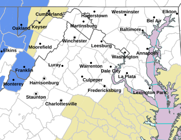
Virginia
Related: About this forumYonnie3
(19,359 posts)Severe Weather Statement
National Weather Service Baltimore MD/Washington DC
1235 PM EDT Mon Apr 13 2020
VAC153-131645-
/O.EXP.KLWX.TO.W.0005.000000T0000Z-200413T1645Z/
Prince William VA-
1235 PM EDT Mon Apr 13 2020
...THE TORNADO WARNING FOR SOUTHEASTERN PRINCE WILLIAM COUNTY WILL
EXPIRE AT 1245 PM EDT...
The storm which prompted the warning has weakened below severe
limits, and has exited the warned area. Therefore, the warning will
be allowed to expire.
A Tornado Watch remains in effect until 600 PM EDT for northern
Virginia.
To report severe weather, contact your nearest law enforcement
agency. They will relay your report to the National Weather Service
Sterling Virginia.
LAT...LON 3858 7739 3861 7743 3867 7730 3860 7724
TIME...MOT...LOC 1635Z 247DEG 33KT 3862 7732
$$
DHOF
mahatmakanejeeves
(69,111 posts)PW County had a big red spot when I posted. That has moved on.
I've got NOAA weather radio on now, on a Bearcat BC278CLT. The storm is headed into SE DC and PG County.
Be prepared for bad weather -- buy a NOAA Weather Radio!
Baltimore-Washington Forecast Office broadcasts over 8 transmitters:
Baltimore (Pikesville) MD -- KEC-83 on 162.400 MHz at 1000 Watts
Hagerstown (Clear Springs) MD -- WXM-42 on 162.475 MHz at 1000 Watts
Manassas (Independence Hill) VA -- KHB-36 on 162.55 MHz at 1000 Watts
Moorefield WV -- WXM-73 on 162.400 MHz at 500 Watts
Frostburg MD -- WXM-43 on 162.425 MHz at 300 Watts
Charlottesville (Covesville) VA -- KZZ-28 on 162.450 MHz at 1000 Watts
Washington DC -- WNG-736 on 162.450 MHz at 300 Watts (fully commissioned as of June 6, 2011)
Fredericksburg VA -- WZ-2527 on 162.425 MHz at 300 Watts
I thought all this time I was listening to KHB-36, but the display says 162.4500 MHz. It must simulcast KHB-36.
Skywarn has been activated. There's a webinar in Charlottesville in a few weeks.
National Weather Service Baltimore/Washington SKYWARN ®
Yonnie3
(19,359 posts)I was at https://www.weather.gov/lwx/ and saw the red spot about when you posted. I looked and the text I posted above was what I saw.
I did the Skywarn for a while. It was lots of years ago.
mahatmakanejeeves
(69,111 posts)It was pouring rain ten minutes ago. I saw my neighbors, older than I am, out for a walk. They got caught in the torrent.
Yonnie3
(19,359 posts)some very wet dog walkers
