Snow blankets Hawaii volcanoes in stunning satellite image
By Harry Baker - Staff Writer 9 hours ago
It's the second-largest area of snow cover since current records began.
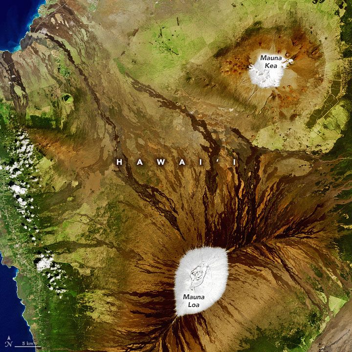
A satellite image of snow on two volcanoes on Hawaii's Big Island.
(Image: © Joshua Stevens/NASA Earth Observatory)
A new satellite image has captured the stunning white peaks of two volcanoes on the Big Island in Hawaii, which have experienced their second-most extensive snow coverage since current records began.
The high-resolution image — snapped on Feb. 6 by the Operational Land Imager (OLI) onboard the Landsat-8 satellite — shows the striking contrast between the snow-covered peaks of Mauna Kea and Mauna Loa and the surrounding volcanic rock.
The OLI, is a joint venture between NASA and the U.S. Geological Survey, and the new image was recently released by NASA's Earth Observatory.
Snow and Hawaii may seem like an oxymoron, but the frozen precipitation falls in Hawaii quite a lot. The volcanic peaks of the dormant Mauna Kea and active Mauna Loa — both over 13,600 feet (4,200 meters) above sea leve, with Mauna Kea being taller by just 125 feet (38 m) — receive at least a light dusting every year, according to NASA’s Earth Observatory.
More:
https://www.livescience.com/hawaii-snow-stellite-images.html?utm_source=notification

 = new reply since forum marked as read
