Science
Related: About this forumScientists detect world's coldest cloud hovering over Pacific Ocean
By Yasemin Saplakoglu - Staff Writer 11 hours ago
The top of the storm cloud reached the stratosphere.
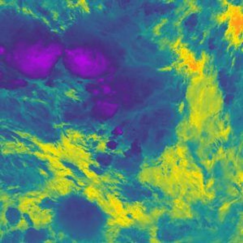
Storms near Nauru on Dec. 29, 20118 captured in infrared by an orbiting satellite. The cold parts of the clouds are in purple and the warm Pacific Ocean is in orange. (Image credit: National Centre for Earth Observation)
A severe thunderstorm cloud that formed over the Pacific Ocean in 2018 reached the coldest temperatures ever recorded, according to a new study.
The very top of the storm cloud reached a bone-chilling minus 167.8 degrees Fahrenheit (minus 111 degrees Celsius), colder than any storm cloud measured before. Thunderstorms and tropical cyclones, a circular low-pressure storm, can reach very high altitudes — up to 11 miles (18 kilometers) from the ground — where the air is much cooler, according to a statement from the U.K.'s National Center for Earth Observation.
But this new temperature is on another level. The top of the storm cloud was about 86 F (30 C) colder than typical storm clouds, according to the statement. The beast of a storm loomed about 249 miles (400 km) south of Nauru in the Southwest Pacific on Dec. 29, 2018, and its clouds' temperature was picked up by an infrared sensor aboard the U.S.'s NOAA-20 satellite orbiting the planet.
Storms typically spread out into an anvil-like shape when they reach the top of the troposphere, the lowest layer of Earth's atmosphere. But if a storm has a lot of energy, it will shoot into the next layer, the stratosphere. This phenomenon, known as an "overshooting top," pushes storm clouds to very high altitudes, where it's bitterly cold.
More:
https://www.livescience.com/super-cold-thunderstorm-temperature.html?utm_source=notification

 = new reply since forum marked as read
Highlight:
NoneDon't highlight anything
5 newestHighlight 5 most recent replies
= new reply since forum marked as read
Highlight:
NoneDon't highlight anything
5 newestHighlight 5 most recent replies

Blue Owl
(58,620 posts)
I_UndergroundPanther
(13,351 posts)Almost gave my phone a bath..

lastlib
(27,806 posts)but you're good.)  - - -
- - - 

msongs
(73,257 posts)
eppur_se_muova
(41,334 posts)Probably not at high altitude, though; CO2 vapor pressure is too low.