Potential '100 Foot' Waves Headed for U.S. East Coast [View all]
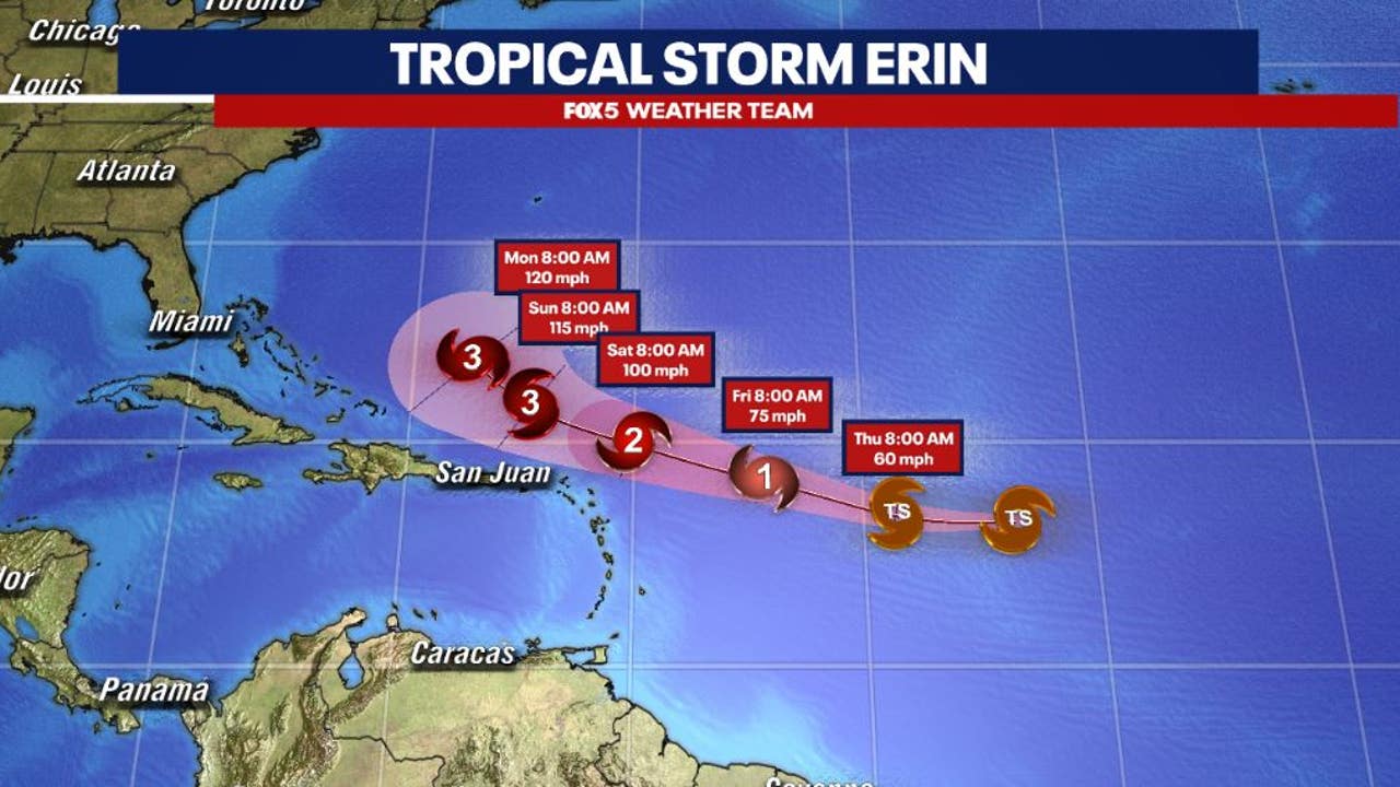
It’s official: Tropical Storm Erin has been upgraded to Hurricane status.
As of Friday, the Category 1 storm (but expected to grow) is moving towards the Caribbean, then it’s slated to curve northeast off the United States’ East Coast by next week – bringing with it heavy rains, flash flooding, gusty winds, and most likely waves.
Regarding the latter, some scientists are predicting potentially huge surf.
.....
Speaking to Newsweek, Jean-Raymond Bidlot, senior scientist in ocean modeling at the European Centre for Medium-Range Weather Forecasts (ECMWF), said: “The latest forecast does indeed indicate that the largest significant wave height could reach values in excess of 50 feet with an associated most likely largest wave of more than 100 feet.”
That’s…absurd. Of course, 100-footers aren’t going to be hitting New Smyrna Beach, up to the Outer Banks, and beyond. But there will be swell, that’s for sure.
Meanwhile other experts, like AccuWeather’s lead hurricane expert Alex DaSilva, downplayed the size potential of the waves. Yet still, it’s significant. DaSilva said: “While 100 feet can’t be ruled out, I think they would only be possible if the storm become a Category 4 or 5 storm. I think waves near the center of 50-75 feet are much more realistic (assuming a Category 3 storm).”
https://www.surfer.com/news/hurricane-erin-100-foot-waves-east-coast
?si=DG0PA2H9yH5FqtKX

 = new reply since forum marked as read